What location sharing solves, and what it does not
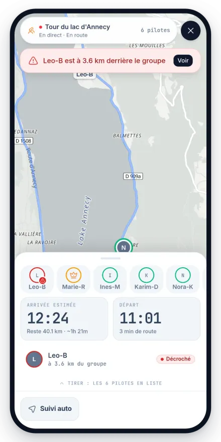
A tracking link answers a real and fairly modest need: the people who care about you know roughly where you are, without you pulling over to reassure them. It earns its keep on a long transit day, on a mountain route that will keep you out for eight hours, or simply when you are getting home late. On a trip abroad it does more work than at home, because whoever is following has no mental picture of the roads you named and no idea how long they take.
Now the part that matters more than any feature on this page. Waver does not detect crashes. There is no fall detection, no automatic alert, no emergency call placed on your behalf if the bike goes down. A lot of motorcycle apps are sold on exactly that promise, so it is worth reading twice: live position is information, not rescue. If accident detection is what you are looking for, get a device or an app built for it, and use Waver for the planning, the guidance and the ride log. Finding out where the line sits belongs at the kitchen table, not at the side of a road.
Who sees what, exactly
Sharing a position shares a lot: your habits, your timings, and the place you leave from every morning. So let us be precise. A live share is only visible to the people who got your link: there is no public list of running sessions, and the link dies on its own after twelve hours. Give it to people you trust, because they see your real position, including where you set off from.
Once you are home, the recorded ride is private by default, and you choose ride by ride who sees it: nobody, your friends, or everyone. On a ride you publish, you can hide the start and the finish: the visible track begins and ends away from the real points, 500 metres by default, adjustable in the app. Your friends always see the full track.
When the signal drops
In the mountains and across empty countryside, mobile coverage disappears for long stretches. Tracking pauses for the duration of the hole and picks up again when the network returns, so the people watching see your last known position rather than an invented one. That is the honest behaviour, and it is worth warning them in advance so a frozen dot does not read as bad news.
The recording of your own ride is a separate matter: it carries on in the phone with no coverage at all. The full track uploads as soon as the connection comes back, without you having to think about it.
If you are riding abroad
Nothing about tracking is tied to a country: the position comes from your phone and the link opens in any browser. What changes when you cross a border is the practical side, mostly data and battery. Riders touring France, the Alps or the Pyrenees for a fortnight tend to hit the same four issues, so they are worth settling before you leave rather than on day three.
- Tracking needs mobile data on your phone. Check what your plan covers in every country you cross, and what it costs per day.
- The person following needs only a browser and an internet connection, wherever in the world they are.
- Deep valleys and high passes cut the signal regularly. Expect the trace to freeze and catch up, and say so to whoever is watching.
- Battery is the real limit before data is: a phone tracking and guiding for eight hours belongs on a charger fitted to the bars.